I continued my quest to hike every foot of charted trail on South Mountain by hiking a portion of Desert Classic Trail with my 12 year-old daughter on Christmas Eve morning in 2013. She had recently hiked it with her 7th grade class, so I asked her to lead the way.
The highlight of the hike was a rest stop on the notorious helicopter pad, which is the highest point on the trail. We walked the perimeter of the helipad and admired the views of million dollar homes, mountains, and clear blue skies. We could even see my daughter’s school where we parked the car.
Desert Classic is appropriately named since it offers a great variety of desert terrain and plant life in a relatively short distance. I found the vegetation to be more noticeably dense and diverse than on many of the trails of South Mountain.
Hike details:
Trail: Desert Classic
Length: 3.5 miles round-trip*
Time: 1.5 hours
Elevation gain: 100 ft.*
Difficulty: moderate
*Rough estimates. I don’t do GPS.
Check out the pictures and captions below for more insights. Click on pics to expand. One of these days, I’ll add highlighted maps showing the exact trail(s) I hiked.
The relatively lush plant life makes this trail unique.
Never know who you might run into on the trail. It was Christmas Eve afterall.
The helicopter pad at the highest point on the Desert Classic Trail offers spectacular views..
Posing for a selfie with my daughter Caymen. She led the way on this hike.
View from the helipad. The notch in the mountains is Telegraph Pass as viewed from the southeast.
Nice little starter castle down the hill from the helipad.
Altadena Middle School, with the white roof, is a great place to park for this hike. You’ll find the trailhead across Desert Foothills Pkwy and up the hill about a block.
Great view of the Estrella Mountain range that runs along the western edge of Gila River Indian Community.
Notice the green foliage that resulted from recent winter rains.
My daughter Caymen leading us to the helipad.
You can see the notorious transmission towers atop South Mountain in the distance.
Not far after this photo was taken the mountain bikers dismounted as the trail got too steep to ride up.
Desert Classic Trail is well-traveled by a variety of users.
Entrance to the segement of the trail that we hiked.
There is a lesson all of us would be independent authors can learn from Walter Swan.
I met Swan in December, 2013. Not in person. That would be tough since he passed away in the 1990s. I picked up an autographed copy of Swan’s book “How to be a Better Me” at a Goodwill store in Tempe one evening. When I first saw the book, I couldn’t help thinking, “There is no way somebody could market a book like this” and “If this guy can sell a book, so can I.”
You know the old saying: You can’t judge a book by it’s cover. That was certainly true with this book.
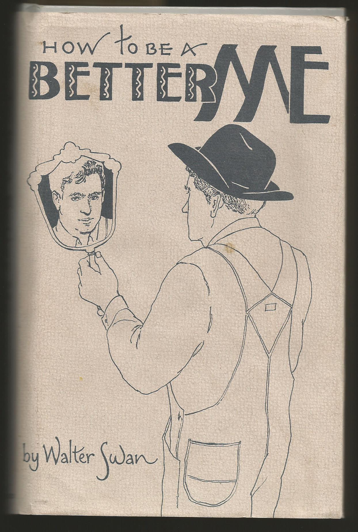
How to be a Better Me, self-published book by Walter Swan
I cracked open the book to get a taste of the author’s style. What I discovered intrigued me: Short chapters of two to three pages with lessons on how to be a better person, written in the language of a good ole boy. I plunked down my dollar-fifty for the book, zipped over to the nearest Starbucks and dug in. Walter had me hooked. I felt like my grandpa was telling me these stories.
After reading the book for a few days, I decided to Google the author and find out more about him. (You should too.) Swan was a retired plaster contractor in southeastern Arizona with no higher education and no prior experience as an author. He couldn’t find a publisher to pick up his book, so he decided to publish it himself, with the help of a printer in Tucson, AZ.
Only a few stores would put his book on their shelves, so he rented retail space in downtown Bisbee, AZ and opened a store to sell his book. He called the store “The One Book Store.” Any guess as to what he sold in that store? It wasn’t the book I picked up. His first book was titled, “Me n’ Henry .” Turns out “How to be a Better Me” was one of many he went on to publish, although it’s hard to pin down all his titles. One person blogged about meeting Swan in 1994 and mentioned he had sold over 35,000 copies. I’m not sure if that’s in reference to his first book or all books combined. Nevertheless, it’s an inspiring number.
Walter has inspired me not only to be a better person, but also to become an author. I have several book ideas and one book that’s about 90% written. I have been sitting on it for about three years since I didn’t feel like I have enough clout. Neither did Swan.
What independent authors can learn from Walter Swan:
If you have good stories (and who doesn’t?), people will read them
Previous experience is not required; nor is advanced education
We don’t need the approval of a publisher to publish a book
These days it’s easier than ever to self-publish books in electronic format with the help of sites like lulu.com and etsy.com. All we have to do is have a vision, a story to tell and the determination to follow it through. It’s that last item that Walter Swan has inspired me with.
Visible to anyone flying into Phoenix’s Sky Harbor Airport isSouth Mountain – a notorious mound of rock bearing a few dozen red-light dotted communications towers. Since one of the trailheads for South Mountain is about a half mile from my driveway, I have taken quite a few hikes on it since we moved to Phoenix in 2012.
It was only recently that I got serious with my goal to hike every foot of marked trail on South Mountain – a 17,000-acre preserve owned and operated by the City of Phoenix. Some sources report South Mountain (pdf map) is the largest city park in the nation. Who am I to question them? For a little perspective, Vail Ski Resort in Colorado measures up at 5,300 skiable acres.
I completed the hike chronicled below with my friend Ken on a beautiful Saturday morning in December, 2013. We were blessed with mostly cloudy skies following a day and a half of rain. We also had a few days of rain a couple weeks earlier, so the mountain was as green I have seen it.
Hike Details*
Trail(s): Bursera Trail to National Trail via Lost Ranch
Length: 5+ miles round-trip
Time: 3.5 hours
Elevation gain: 800 ft. (ballpark)
Difficulty: hard
*Rough estimates. I don’t do GPS.
Click photos to enlarge.
View of South Mountain from the back patio of our home. Bursera Trail lies just over the visible peak.
View of the Estrella Mountain Range on Gila River Indian Community land.
Bursera Trail descending from it’s peak elevation.
Scenic switchback on the descent.
Classic desert scene on the Lost Ranch segment of the hike.
We saw three entrances to abandoned mines like this one on our trek.
Interesting rocks and rock formations add some intrigue to the hike experience.
Hills are alive with greenery thanks to recent rains. These little plants will be flowering before long.
One of many lookout points along the south rim of the Grand Canyon.
I’m creating this list for my family and me, but thought I’d share it for anyone else who might be interested. We just moved to AZ in 2012.
I became aware of many of these sight from the Arizona Highways Magazine TV show and Facebook page. If there are other sites you would recommend, please leave them in the comments box below.
If you are a bargain shopper, your ship is about to come in. Four of the best bargain hunting days of the year on Ebay are just around the corner: December 24, 25, 31 and January 1.
Here’s why: Ebay is an auction site. There is only one thing that makes prices go up with an auction. People. If you are shopping on Ebay when hardly anyone else in the country is, you can pretty much have your way with prices. What are people doing on the aforementioned dates? Answer: Not shopping on Ebay.
My top tips to save big on Ebay this holiday season:
Set up an Ebay and Paypal account in advance. Many sellers only take payments by PayPal these days. Trust me, it’s super safe and convenient.
Know what you want to buy and what you are willing to pay. Don’t let your ego cost you money. If somebody happens to outbid you, don’t sweat it. Just move on to another seller or the next item on your list.
Narrow your sights on things that are easy and inexpensive to ship or mail. If you pay $1 dollar for an item you could buy locally for $10 and it costs you $20 for shipping, you haven’t really saved anything.
Place your max bid on the items you desire just minutes before the auction closes. If there are no other bidders, you won’t have to pay your max price, but it helps you automatically outbid other bargain hunters.
This concept only works if you are trying to win auctions that are closing on the dates I highlighted above. Don’t bid on items that will be closing on days after the dates listed above. Set your top price low and be okay with spending not a penny more, even if it means losing the item to someone else who read this post.
I discovered this tactic as a seller over 12 years ago when I inadvertently listed an item for auction that closed on a holiday. I didn’t get near the money that I was asking for the item but I learned a lesson that has paid me back greatly over the years. Few sellers put much thought into when the auction will close. Usually, they are just happen to get the item listed.
If you follow these tips and score big, please come back and leave a comment.
I’ve been prepping myself for a 3-day hike in the Grand Canyon in May 2014 by taking on some of the more strenuous trails around Phoenix. Camelback Mountain has a reputation for setting the legs on fire, so when I saw that my church had organized a hike up the humps the first weekend of December, I couldn’t pass it up. Below is a quick summary of my experience.
At the time of our hike, the only way to access the top was via Cholla Trail (pronounced choy-ya) which rises up from the east side. In the picture below, envision hiking a trail cut just on the other side of the spine of the camel that runs from the right (or rear) to the left.
Quick stats:
Destination: Camelback Summit – the top of the tallest hump in pic above
Distance: about 3 miles round trip
Elevation gain: 1,300 feet
Time: 3.5 hours; time of day: early morning
Weather: sunny with calm air and temps in the mid-50s
Likes:
Free admission
Views from the top and other vantage points
Desert landscape
That burn in the legs
Dislikes:
Parts of trail require scaling rock walls and navigating back down them
Concern of bee attacks as advised by signs (bees killed a few people on Camelback in 2013)
Volume of other hikers on the weekend resulted in congestion
Parking a half mile from the trail head on a residential street
Conclusion
I’m glad I hiked Camelback so that I can say that I’ve done it, but I won’t be rushing back anytime soon. The single biggest turnoff was the volume of people. Friends have recommended other trails that will help prep me for my Grand Canyon hike, so I’ll place priority on those trails in the future.
If you have hiked Camelback, I would like to hear your thoughts in the comment box below. Questions? Fire away and I’ll do my best to answer them.
Some more pics from my hike (click to enlarge)…
Overlooking the Phoenician Resort
Some members of our hiking party approaching one of many steep segments of the trail.
A cool feeling visual you don’t get very often in the Phoenix area.
A brief stop along the trail to admire the valley view.
Another steep section of trail. Notice the helicopter landing pad for mountain rescues in the upper left third of the pic.
Somehow we need to get to where the gent in the upper right is.
This Christmas tree is at the summit. Another hiker there that day said she saw a couple 20-somethings carrying it up a few days earlier.
Descending Cholla Trail. Good view of a golf course in the upper half of the photo.
Uphill and downhill hikers often negotiate tight spaces on the narrow trail..
I’m sure more than one developer has thought of building a resort up here too.
Nature showing off its amazing ability to adapt to harsh environments.
This is the top of Camelback from a viewpoint several hundred yards before the final ascent.